Find Land Surveyor in Your Area
- Land Surveyor in Edmonton
- Land Surveyor in Victoria
- Land Surveyor in Winnipeg
- Land Surveyor in Fredericton
- Land Surveyor in St. John's
- Land Surveyor in Yellowknife
- Land Surveyor in Halifax
- Land Surveyor in Iqaluit
- Land Surveyor in Toronto
- Land Surveyor in Charlottetown
- Land Surveyor in Quebec
- Land Surveyor in Regina
- Land Surveyor in Whitehorse
Discover Expert Land Surveyor Services Near You in Canada
Land surveying is the science of precisely measuring and mapping the physical features of a piece of land, including its boundaries, elevations, and contours. A professional land surveyor combines field measurements, historical research, and advanced technology to determine exactly where property lines fall and how the land is shaped. The result is a detailed survey plan or report that becomes a legally recognized document.
You may need property surveying services in a variety of everyday situations. Homebuyers often require a survey before closing to confirm what they are actually purchasing. Homeowners planning a fence, a pool, or an addition rely on a boundary survey to avoid encroaching on a neighbour’s property. Builders and developers use construction land surveyors to stake out foundations and ensure structures go up in the right place. In cases of disagreement, a boundary dispute survey specialist can provide the impartial evidence needed to settle conflicts.
Without a licensed land surveyor, critical decisions about land are based on guesswork. Old fence lines, faded markers, and tax maps are not reliable indicators of true boundaries. Only trusted land surveying professionals can legally define those lines and produce the official plans required for permits, financing, and legal protection. Hiring a qualified professional turns uncertainty into documented fact and safeguards one of your largest investments.
Common Land Surveying Services
- Boundary surveys to locate and mark exact property lines
- Topographic surveys mapping elevation changes, trees, and terrain features
- Construction staking and foundation layout for new builds
- Subdivision surveying to split a parcel into separate lots
- Land title surveys (often required for real estate transactions)
- Mortgage survey services for lender requirements
- Property line verification for fence installation or dispute resolution
- ALTA/NSPS-style detailed surveys for commercial property transactions
- Elevation and contour surveys for flood zone determination
- Site analysis and feasibility studies for land development
- Cadastral mapping and land records research
- Utility and infrastructure mapping for underground service locations
- GPS and drone-based surveying for large or hard-to-reach sites
- As-built surveys to confirm construction matches the design
Your Future Land Surveyor Hero Is Just One Task Away — Let’s Find Them
How a Professional Land Survey Works: Step by Step
Understanding the process helps you know exactly what to expect when you hire site measurement experts. While every project is unique, the typical sequence follows a clear, methodical path.
- Initial consultation and scope definition. You explain your needs—whether it’s a boundary staking, a topographic map, or construction layout. The surveyor recommends the appropriate type of survey and discusses your timeline.
- Research and records retrieval. The surveyor gathers title documents, previous surveys, subdivision plats, and legal descriptions. This research is essential for accurate property boundary assessment and often uncovers easements or discrepancies.
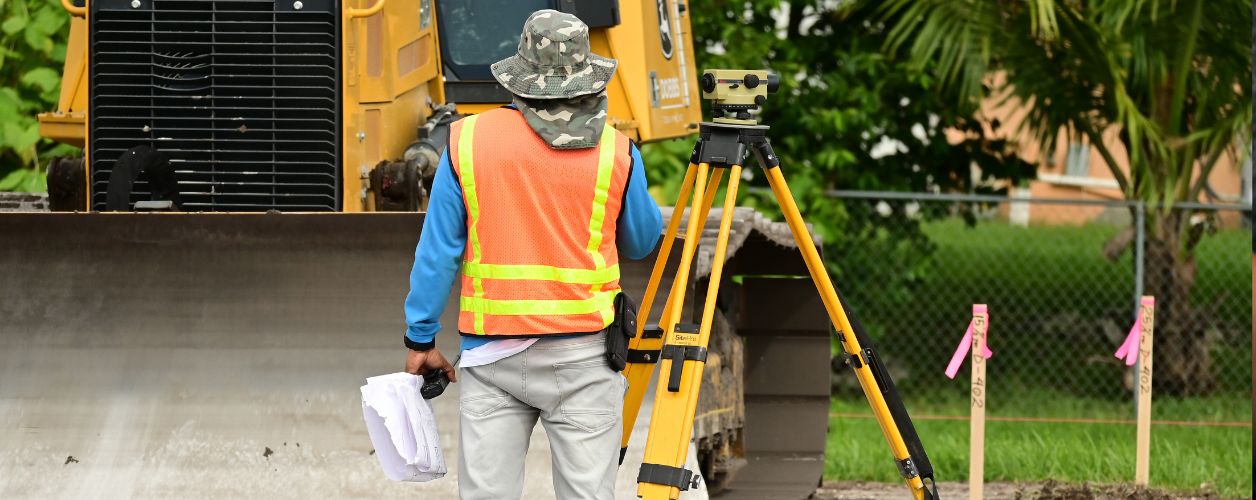
- Field work and data collection. Using total stations, high-precision GPS receivers, and often drones, the crew measures the site. They locate existing monuments, property corners, buildings, and natural features. Modern land mapping services combine terrestrial and aerial methods for speed and precision.
- Data processing and mapping. Back in the office, field data is processed, adjusted, and used to create the survey drawing. Professional terrain mapping specialists generate contour lines, calculate areas, and note setbacks.
- Plan preparation and review. A licensed professional land surveyor certifies the final plat, survey report, or digital file. The document will show boundary dimensions, easements, encroachments if any, and all relevant features.
- Delivery and explanation. The surveyor walks you through the results, explains any boundary issues, and marks the corners with durable stakes or monuments so you can see the lines on the ground.
- Recording (if applicable). For subdivisions or land title changes, the surveyor may submit the survey to the appropriate land registry office.
How to Choose the Right Land Surveyor
With a wide range of reliable surveying companies and independent professionals available, focusing on a few key factors helps you find the best fit. A careful selection process protects your timeline, budget, and property rights.
Verify Licensing and Insurance
Boundary determination is a regulated profession. Always ask to see a current license and confirm the surveyor is in good standing with the licensing body. A legal property surveyor carries professional liability insurance, which protects you if an error occurs. Never hire anyone who cannot provide proof of licensure.
Match Experience to Your Project
Residential land surveyors handle day‑to‑day tasks like fence line marking and mortgage surveys, while commercial land surveying services tackle multi‑parcel developments, high‑accuracy title surveys, and complex terrain. Ask directly how many similar projects the firm has completed. A cadastral survey specialist will have deep expertise in boundary re‑establishment, while a construction layout survey expert understands reading architectural plans and staking grid lines.
Evaluate Tools and Technology
Modern GPS land surveying services and drone surveying experts can dramatically reduce field time on large rural sites or difficult terrain. Ask what equipment the crew uses and whether it improves accuracy or efficiency for your situation. High‑quality land mapping services also rely on robust software for processing and drafting.
Prioritize Clear Communication and Timelines
Responsive, transparent communication is a sign of a professional who respects your time. During your first contact, note how promptly they reply, whether they listen carefully to your needs, and if they give a realistic completion window. For time‑sensitive work like subdivision surveying or construction staking, confirm they can meet your deadline.
Compare Pricing and What Is Included
Request itemized quotes from multiple firms. Affordable land surveying services exist, but the lowest price may exclude monumentation, rush fees, or research. Make sure you understand exactly what the price covers—field work, the stamped survey plan, corner markers, and any revisions.
Understanding the Cost of Land Surveying
Surveying fees depend on many variables, and there is no single flat rate. The table below shows typical price ranges you might encounter for common survey types. Use these as a general guide, not a fixed quote.
| Survey Type | Typical Price Range ($) |
|---|---|
| Boundary survey (standard residential lot) | $500 – $1,500 |
| Mortgage / location survey | $350 – $800 |
| Topographic survey | $1,000 – $3,000 |
| Construction staking (single-family home) | $800 – $2,500 |
| Subdivision survey | $2,500 – $10,000+ |
| High-detail land title survey (commercial) | $2,000 – $6,000 |
| Elevation certificate / flood hazard survey | $400 – $1,000 |
What affects the price? The main factors are property size, terrain difficulty, tree cover, season, research complexity, and travel distance. Rush jobs or winter work often carry a premium. A survey with extensive title research or a messy boundary history will cost more than a simple staking of a recently surveyed lot. Always discuss these variables with several professional land surveyors to understand why one quote may differ from another. Accurate property surveying contractors will explain the breakdown clearly.
Your Future Land Surveyor Hero Is Just One Task Away — Let’s Find Them
Common Situations Where a Survey Is Essential
- Purchasing a home and wanting to avoid boundary surprises
- Building a fence and needing clear property line verification
- Planning a home addition, deck, or shed near setback limits
- Resolving a neighbour dispute over tree ownership or encroachments
- Subdividing land for sale or family transfer
- Applying for a building permit that requires a site plan
- Refinancing when the lender requests a current survey
- Installing a septic system or well that must respect frontage requirements
- Beginning a major landscaping or grading project
- Registering an easement or right‑of‑way
- Developing raw land where no reliable survey exists
- Verifying acreage for agricultural land transactions
Questions to Ask Before You Hire
Getting the right answers early prevents delays and unexpected costs. Use these questions when speaking with reliable surveying companies.
- Are you licensed, and can I see your certificate of authorization?
- What type of survey do I actually need for my project?
- Does your quote include monumenting the corners with durable markers?
- Will I receive a stamped hard copy, a digital file, or both?
- How long will the field work and final plan take?
- Who handles filing the survey with the land titles office, if required?
- Can you explain any encroachments or easements that show up?
- Do you carry professional liability insurance?
- Will you walk the property with me once the survey is done?
Common Mistakes to Avoid
Avoiding these pitfalls helps you get a survey that truly protects your interests.
- Assuming an old survey is still accurate. Monuments get disturbed, and previous surveys may contain errors. Always get a current survey for a transaction or construction.
- Choosing a surveyor based on price alone. The lowest bid might skip corner setting, research, or important liability coverage.
- Not sharing the full picture. Tell the surveyor about any known disputes, missing markers, or unusual terrain, or you risk an incomplete job.
- Confusing a tax map with a survey. GIS maps and assessment drawings are not legal boundary documents and can be off by several metres.
- Starting construction before the survey is staked. Pouring concrete or moving dirt without a construction layout can lead to costly tear‑outs and neighbour conflicts.
- Ignoring easements. An easement may restrict where you can build. Ask the surveyor to clearly mark any utility or access easements.
- Relying on smartphone GPS apps for boundary lines. Consumer‑grade GPS is not survey‑grade and cannot replace a professional boundary survey.
- Not checking communication style. Unreturned calls during the quoting stage often signal future delays.
Cost Guide
Related Categories for Green Energy Diagnostics
Find Land Surveyor in States
- Land Surveyor in Alberta
- Land Surveyor in British Columbia
- Land Surveyor in Manitoba
- Land Surveyor in New Brunswick
- Land Surveyor in Newfoundland and Labrador
- Land Surveyor in Northwest Territories
- Land Surveyor in Nova Scotia
- Land Surveyor in Nunavut
- Land Surveyor in Ontario
- Land Surveyor in Prince Edward Island
- Land Surveyor in Quebec
- Land Surveyor in Saskatchewan
- Land Surveyor in Yukon
Answers to Your Common Questions
A land surveyor measures and maps out property boundaries, land features, and legal descriptions. Their work is essential for real estate transactions, construction projects, fence placements, and resolving boundary disputes.
You should hire a land surveyor when buying or selling property, building a fence, adding a structure, subdividing land, or if there’s any uncertainty about property lines. It's also crucial before applying for permits or rezoning.
Costs typically range from $400 to $1,200, depending on property size, terrain complexity, location, and type of survey (e.g., boundary, topographic, or construction staking). Larger or rural lots may cost more.
Land surveyors can provide boundary surveys, ALTA/NSPS surveys, topographic surveys, construction layout surveys, and easement or flood zone evaluations, depending on your project needs.


